Short answer: free, foot access only, 8am to sunset, and there is nowhere to park — not for cars, not for golf carts. Walk or bike from Silver Lake; it's about twelve minutes. The trail is narrow, sandy and rugged, and it ends on a sound-front beach. The water off that beach is Teach's Hole.
What it is, and who owns it
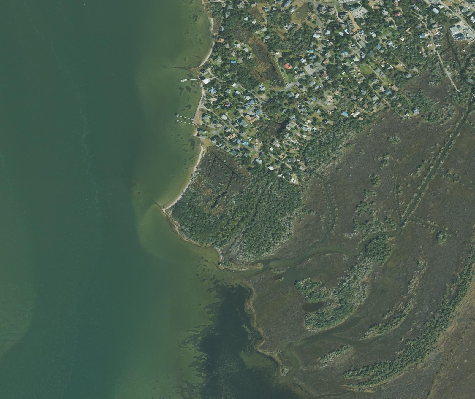
Springer's Point Preserve is 132 acres of maritime forest, tidal red cedar forest, salt marsh, wet grassland and sound-front beach at the southwest end of Ocracoke village. It belongs to the North Carolina Coastal Land Trust, which assembled it over nearly twenty years: 31 acres in 2002, another 91 in 2006, two soundfront acres in 2020, and a final nine-acre tract at the entrance in September 2021 that completed the preserve.
That matters more than it sounds. Maritime forest is the most endangered habitat type in North Carolina — coastal development has, in the state wildlife agency's own words, "literally destroyed much of the maritime habitats." Ocracoke has one substantial block of it left, and this is it. The reason it survived is elevation: the on-site marker records that Springer's Point is the highest ground on Ocracoke Island, which is also why a mature forest could take hold on a sand bank in the first place.
The rules, and the one that gets people in trouble
Straight from the Coastal Land Trust, because the wording is worth reading:
"NO PARKING OF CARS AND GOLF CARTS. If you have parked along the road, please move your car or golf cart immediately!"
Loop Road is a narrow residential lane. There is no lot, no pull-off and no shoulder, and the preserve's own signage is aimed squarely at visitors who try anyway. Walk or bike from the village and leave the bike at the rack by the kiosk.
- Hours. 8am to sunset. The Land Trust's page says "Tuesday – Sunday (closed Mondays)" at the top and "8am to sunset daily" further down — its own two statements disagree. Assume Mondays are out and check their page before you plan around it.
- Foot access only. No motorized vehicles. No bikes on the trails; there's a rack at the entrance.
- Dogs are welcome on leash, and you pick up after them.
- Stay on the trail, and stay off the rock jetty, the shoreline rock and the oyster-shell sill. That sill is a living shoreline the NC Coastal Federation built in 2012 with bagged oyster shell and native marsh plantings to stop the point eroding. It is doing a job.
- No camping, no fires, no smoking, no alcohol. Don't disturb the cistern or the gravesite.
- Bring bug spray. The Land Trust warns about biting insects and poisonous plants, and it isn't being dramatic.
Getting there
The trailhead is at 104 Loop Road, roughly six-tenths of a mile from Silver Lake harbor and about a quarter mile from the Ocracoke Lighthouse — twelve to fifteen minutes on foot from the harbor. From Silver Lake, follow NC 12 to Lighthouse Road and on to Loop Road.
What you're looking for is an information kiosk and a bicycle rack, and a sandy path disappearing under live oaks. There is no gate, no sign you can read from a moving vehicle, and no parking lot. People walk past it. Legal parking nearest the trail is back toward the village — the Ocracoke Assembly of God church lot, under half a mile away, takes donations.
The walk in is short. Sources disagree on the exact distance — half a mile round trip in one account, eight-tenths of a mile in another, and the Land Trust gives no figure at all — so call it ten to fifteen minutes each way on a narrow, rugged, sometimes wet sand path. No boardwalk.
Teach's Hole, from the beach
This is the reason to make the walk. The trail comes out on a public beach on Pamlico Sound, and the channel off that shore is Teach's Hole — the deep water where Blackbeard anchored his sloop Adventure and where Lieutenant Robert Maynard's men killed him on November 22, 1718.
The National Park Service describes this exact walk: a visitor to Ocracoke may take a nature trail down to Springer's Point, a public beach on the sound, and look out over the water where it happened. That's a federal agency putting the trail and the battle in the same sentence, which is more than most pirate stories on this coast can claim.
There's no marker out there. There's nothing to mark. The full account of the fight is here, and the charts that put his name on that channel — "Thatches Hole" in 1733, "Teachs Hole" in 1808 — are in the case file.
"Teach's Plantation" — what's actually documented
You will read that this land was Blackbeard's, that it was called Teach's Plantation, that he kept a house here. Handle that carefully.
The phrase circulates, always in the same hedged form — the Coastal Land Trust itself writes that the land "has been referred to as Teach's Plantation." No deed, land grant or colonial record is known to use the name. The federal National Register nomination for the Ocracoke Historic District says the island has "a long and colorful history full of tales of Blackbeard and other pirates, much of which is not well-documented," and notes there is limited physical evidence here predating the late nineteenth century. Blackbeard's documented house was in Bath.
What is better attested is the meeting. The historical marker at the trailhead records that in September 1718 Teach hosted Charles Vane, Robert Deal and Calico Jack Rackham here — described on the marker as the largest gathering of pirates ever held on the mainland of North America. The gathering itself is well documented in the histories; pinning it to this specific point is the local attribution, and that's how we're stating it.
How it got the name, and who's buried there
Not from a pirate. From a Philadelphia couple.
- William Howard bought all of Ocracoke Island in 1759 for £105 sterling. He is said by some historians — Kevin Duffus makes the fullest case — to have been Blackbeard's quartermaster, pardoned in 1718 and still alive at 108 in 1798. The genealogist Dora Padgett put his birth around 1700, which would make him far too young. It is unresolved, and anyone who tells you flatly that Ocracoke was bought by one of Blackbeard's crew is skipping the argument.
- A later William Howard, a descendant, held the point itself from about 1820 until his death in 1851.
- Daniel Tolson bought it in 1855, lived on it, died in 1879 and is buried there, in a tangle of cedars and briars away from the path.
- E. D. and Clara Springer bought it in 1883. That is where the name comes from. They never lived on it permanently; their son Wallace was the last person to live in the house.
- Sam Jones, the Norfolk foundry owner who married an Ocracoke woman and built Berkley Manor and Berkley Castle in the village, bought the point in 1941. He died on September 27, 1977 and is buried at Springer's Point beside his favorite horse, Ikey D. That one is not folklore — the National Register nomination says it.
The only building left is a brick cistern E. D. Springer put up in 1899. The Springer house is gone; local tradition holds that a house in the village was framed with lumber salvaged from it.
Two things people mix up: Berkley Manor is in the village, not on the preserve, and so is the British Cemetery. Neither is out here.
What it looks like now
Live oak, red cedar and loblolly pine over a sand floor, with salt marsh behind and the sound in front. The Land Trust calls the oaks ancient and everyone repeats it; nobody has ever cored one, so take "centuries old" as a description rather than a measurement.
Hurricane Dorian went through here on September 6, 2019 and took live oaks off the sound shore, dropped trees across the forest and carried off benches and signs. It reopened that December with work continuing into 2020 — and the Land Trust deliberately left the non-hazardous fallen trees where they landed, to let the forest sort itself out. Some of what you climb over is Dorian. The island's full hurricane record is here.
Mistakes people make
- Driving or golf-carting to the entrance. There is nowhere to put it, and you'll be asked to move.
- Riding a bike past the kiosk. Bikes stop at the rack.
- Turning up on a Monday.
- Expecting a boardwalk, a bathroom or a bench. None of that exists out here.
- Standing on the oyster sill or the jetty for a photo. That's the restoration.
- Confusing it with the British Cemetery, which is a five-minute walk away in the village and a completely different story.
- No bug spray, in July.
The walk is better with a reason
Blackbeard's Gold: The Crossing starts in the ferry line and ends, if you'll walk for it, on that beach — case file in hand, three hundred years of argument behind you, looking at the water he went into. $29 per team, and the trail is free.
Start the Hunt — $29 per team Pick your crossing$29 per team of up to six, not per person. Your team link arrives by email straight after checkout. Nothing to install.
Common questions
- Is Springer's Point free?
- Yes. No fee, no gate, no booth — it's a private nature preserve open to the public on foot.
- Can I park there?
- No, and this is the rule the Land Trust states most forcefully. No cars, no golf carts, not on the road either. Walk or bike from the village.
- Can you actually see Teach's Hole?
- Yes — the trail ends on a sound-front beach and the channel off that shore is it. Nothing marks the spot.
- Was this really Blackbeard's land?
- Tradition says so; the paperwork doesn't. "Teach's Plantation" appears in modern retellings, never in a deed anyone has produced. The pirate gathering of September 1718 is on firmer ground.
- Can I bring a dog?
- Yes, on leash, and clean up. No bikes on the trail, no vehicles, no fires, no alcohol, and stay off the oyster sill.
Sources
Ownership, acreage, hours and the full rules: North Carolina Coastal Land Trust, Springer's Point Preserve. Acquisition timeline including the 2021 completion: NC Coastal Land Trust and Coastal Review. Teach's Hole, the Adventure, the November 22, 1718 fight, and the description of the nature trail to the sound-front beach: National Park Service, Cape Hatteras National Seashore. The 1990 National Register nomination for the Ocracoke Historic District on the documentation of the island's pirate history, and on Sam Jones and his burial. Chain of title from William Howard through Tolson, Springer and Jones, and the 1899 cistern: Philip Howard, "History of Springer's Point," Village Craftsmen. The September 1718 pirate gathering and the island's highest ground: the historical marker at the trailhead, erected by the Jandy Ammons Foundation. The William Howard quartermaster debate: Coastal Review, summarizing Kevin Duffus and Dora Padgett. Maritime forest as the state's most endangered habitat: North Carolina Wildlife Resources Commission. The 2012 living shoreline: North Carolina Coastal Federation. Hurricane Dorian damage and reopening: Coastal Review, January 2020.